Saturday, January 17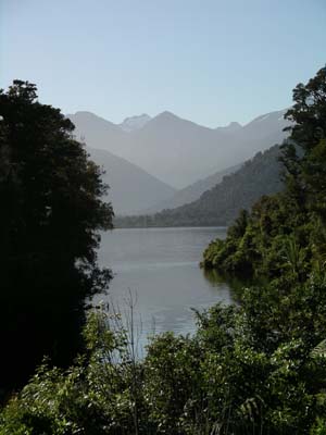
Paula: Another sunny day greeted us this morning and we started
off early with a hike around the lodge to learn about the area. We viewed
the hydro-generator that supplies much of the lodges' power (they also have
a diesel generator for back up). We were surprised to find out that the Conservation
Commission here will no longer allow hydro generators because they regard
it as changing the environment. It was interesting to learn that the lodge
also measures rain levels and fault activity for the country. Swade, who helps
manage the lodge, showed up the equipment and explained how it worked. He
also explained how the tectonic plates are colliding in the area and why they
are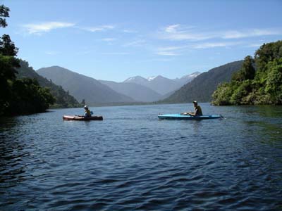 expecting to have a strong earthquake in the next century along this fault
line. Later in the day when we walked to the beach, we were able to see how
layers of sediment have been raised over millions of years along this fault
line.
expecting to have a strong earthquake in the next century along this fault
line. Later in the day when we walked to the beach, we were able to see how
layers of sediment have been raised over millions of years along this fault
line.
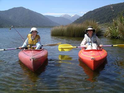
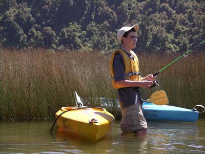
We spent a good part of the day exploring the lovely lake in our kayaks.
We had fun looking for good fishing spots and were often spread out on the
coves of the lake each trying to catch a trout. It was wonderful to relax
and fish on this beautiful lake surrounded by beautiful 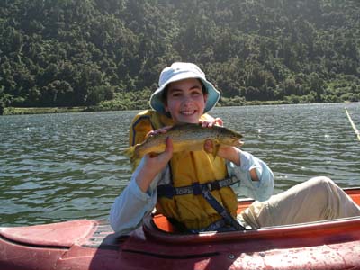 mountains
and snow-capped peaks. Katie was the lucky fisherman today - she was thrilled
to successfully land a nice brown trout! More fishing will definitely be in
our future plan
mountains
and snow-capped peaks. Katie was the lucky fisherman today - she was thrilled
to successfully land a nice brown trout! More fishing will definitely be in
our future plan s
as we all loved fishing in our own kayaks. There were also many beautiful
ducks and birds on the lake and the mountains were crystal clear against the
blue sky.
s
as we all loved fishing in our own kayaks. There were also many beautiful
ducks and birds on the lake and the mountains were crystal clear against the
blue sky.
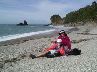
Before dinner, we hiked about 45 minutes down to Monro Beach. The walk was
in dense rainforest with soft and rough tree ferns surrounding the path. The
new fern growth was fascinating and Katie thought some of the seedlings looked
like tarantula legs. There were also large fichus and kahikatea trees. The
kahikatea trees used to cover New Zealand 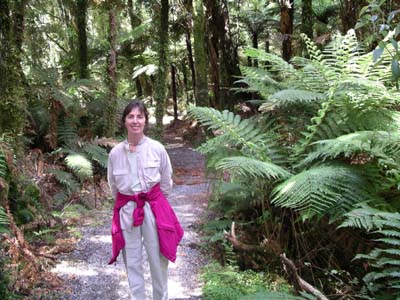 years
ago but now only 2% survive. This ancient tree represents the variety that
existed in New Zealand before it drifted away from Gondwana (a
years
ago but now only 2% survive. This ancient tree represents the variety that
existed in New Zealand before it drifted away from Gondwana (a 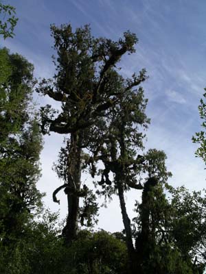 giant
landmass that existed around the South Pole until 100 million years ago when
it separated into India, Africa, Australia and New Zealand). Our walk through
the rainforest reminded us of our trip to Costa Rica. The trees were covered
with moss, vines and epiphytes such as orchids.
giant
landmass that existed around the South Pole until 100 million years ago when
it separated into India, Africa, Australia and New Zealand). Our walk through
the rainforest reminded us of our trip to Costa Rica. The trees were covered
with moss, vines and epiphytes such as orchids.
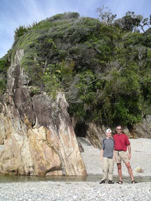
This area of rainforest cleared abruptly when we reached the coastline. The
beach was composed of multicolored smooth pebbles that have been transported
along the coast from the many rivers draining from the countryside. The kids
had fun collecting the beautiful stones and we identified some as quartz,
sandstone and basalt. I enjoyed finding unusual shells - some like I have
never seen before. The waves were large and splashed into large boulders deposited
at the end of either side of the beach. We took time to examine the 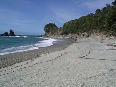 sedimentary
layers in the rock which have been lifted and tipped more than 90 degrees
at the fault line. These layers represented New Zealand as far back as 490
million years ago!
sedimentary
layers in the rock which have been lifted and tipped more than 90 degrees
at the fault line. These layers represented New Zealand as far back as 490
million years ago!
 This
beach is also the breeding ground of a colony of rare Fiordland crested penguins.
There are 15 pairs that nest here, and they mate for life. Unfortunately,
the penguins complete their breeding in December and are now out at sea. The
sand flies finally chased us back into the rainforest and back to the lodge
for dinner. It was a fun but exhausting day and we were all asleep before
the summer's sky had completely darkened.
This
beach is also the breeding ground of a colony of rare Fiordland crested penguins.
There are 15 pairs that nest here, and they mate for life. Unfortunately,
the penguins complete their breeding in December and are now out at sea. The
sand flies finally chased us back into the rainforest and back to the lodge
for dinner. It was a fun but exhausting day and we were all asleep before
the summer's sky had completely darkened.
Tomorrow is supposed to bring some of the rains that the west coast is famous for. In fact, this area gets 200 inches of rain every year. If so, we'll probably take advantage of the time to catch up on our reading and studies.
Katie's Kwick Kwacks: The Geology of Monro Beach. Today we went to a very interesting beach called "Monro Beach." We were curious to learn the geological significance of the beach after being able to see many different layers of rock in the large boulders surrounding the beach. We learned that about one hundred million years ago, New Zealand, Australia, Antarctica, Africa, India, and the South Pole were together in a single land mass called Gondwana. The area eventually spread apart forming some of the countries and continents we know today. Two plates from this land mass are still rubbing together today and are known as the Indo-Australian and Pacific tectonic plates.
Many years ago the tectonic plates rubbed together so fiercely that they created an island that we now call New Zealand. New Zealand is on what we call the fault line - the collision point between the two plates. Because of the plates constantly rubbing, with New Zealand in the middle, its shape is constantly changing. It also suffers from many earthquakes. We learned that the plates gradually collided under the island, pushing the land up to form the Southern Alps. When the land got pushed up it formed sediment layers. These sediment layers were formed by dead sea creatures compressing together. Geologists can now study those layers by drilling through the rock and observing each layer and its unique qualities. They can determine when the layer was formed, how many sea creatures died that year among other things. The oldest layers are underneath the rest and are the most compressed.
The interesting thing about Monro Beach was you could see several of the different sediment layers in the rock. We learned that this happened because when the two plates collided they pushed some of the sediment layers upward onto the coast making them visible on the outside of the rock. We heard that the oldest recorded sediment layer was four hundred million years old. As you can see, we are learning a good amount of geology in New Zealand and find it to be incredibly interesting.
David's Daily Dump: Living in the Wilderness. This morning we took
a hike around the lodge property learning about how the lodge is able to live
in the rain forest. We learned about how the lodge produces energy and how
they provide information for the government. The lodge uses the nearby river
to produce hydroelectric power. They made a small canal to divert part of
the stream into the forest where it runs through a small station. Inside the
station, the water turns an impellor (a big wheel) which spins a number of
other small wheels creating electricity. The power is then distributed amongst
the rooms and lodge facilities. Although hydroelectric power is very clean
and useful, it does not produce enough power for the whole lodge. When all
the rooms are full, or a big group gets back from a wet hike and is looking
to take a warm shower, the diesel generator is turned on. The diesel generator
produces twice as much energy as the hydroelectric station, but is not the
cleanest type of energy. It is only turned on when needed, and can be extremely
useful when short of power.
The Lake Moeraki Lodge also supplies information to the government concerning
the weather patterns. It has a rain catcher, which records the amount of rain
that the area gets in a day, week, month, or year. The lodge also has an earthquake
sensor, which is located 60 meters underground. It is used to detect any earth
movements, and is extremely sensitive. It is so sensitive that it has picked
up vibrations from tourist buses up in the parking lot, and waves crashing
over two miles away!